Introduction #
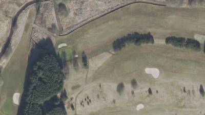
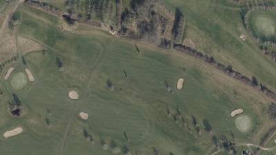
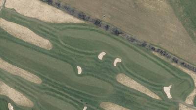
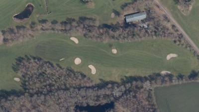
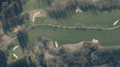
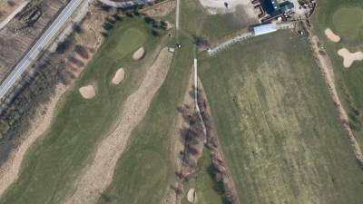
The authors of the Danish Golf Courses Orthophotos dataset present a system designed to assist golf course raters in evaluating the difficulty rating of golf holes. Traditionally, this process involves time-consuming manual measurements on the golf course, which the authors aim to automate partially. They achieve this by training a U-net neural network to classify various elements on golf courses, including green, fairway, tee, bunker, and water bodies. This system helps measure distances between relevant course components. Notably, prior to this work, there were no publicly available datasets containing golf course data. To address this gap, the authors introduce a new public dataset of golf courses created from orthophotos. This dataset comprises 1,123 RGB orthophotos for training and validation, along with 108 RGB orthophotos for testing, all collected from 107 Danish golf courses during the spring season. The dataset includes manual annotations.
In the context of golf, a handicap system allows players of varying skill levels to compete fairly. This system relies on players’ skill levels, known as handicap indexes, and the course rating to allocate the number of shots players receive on each hole based on their playing handicaps.
Historically, determining the rating of golf courses has required labor-intensive measurements performed by a team of four golf course raters. These measurements encompass various factors, including fairway width, green size, distances to obstacles, bunker depth, grass length, tree presence, green slope, elevation, and topography. These measurements are then used to compute the course rating using a complex and confidential set of rules. This manual process is both time-consuming and limits measurement precision and consistency. The authors highlight the advances in satellite observation systems in the 20th and 21st centuries, which have improved the acquisition of accurate remote sensing data for land cover analysis and green space monitoring. They propose that some metrics relevant to golf course ratings could be extracted from overhead imagery.
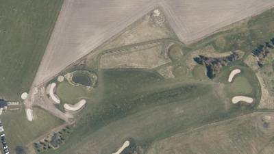
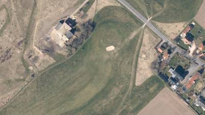
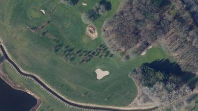
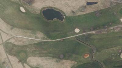
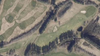
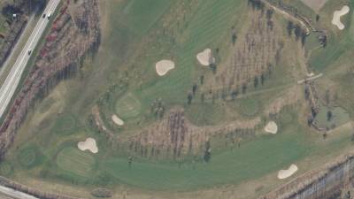
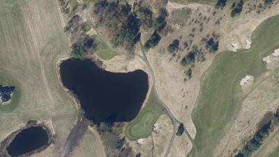
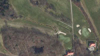
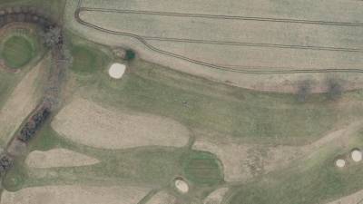
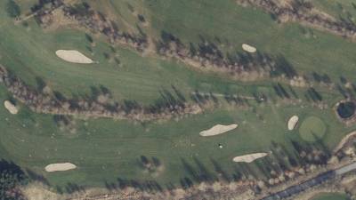
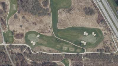
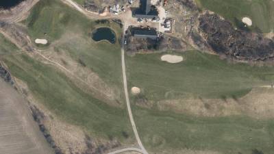
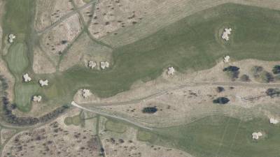
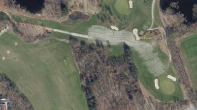
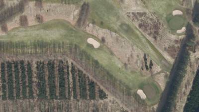
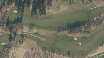
For data collection, the authors utilized the national database “Dataforsyningen” (DF) to obtain 1,123 RGB orthophotos from 107 Danish golf course during the spring season. These images were randomly divided into training and validation sets in a 70/30 split. Expert annotations focused on classes such as greens, fairways, tees, bunkers, water, and background. Trees and classes that couldn’t be reliably differentiated at a scale of 1:1000 were omitted. An additional 108 images were collected for testing, spanning scales of 1:1000, 1:1250, and 1:1500 to ensure that testing images represented the layout of a single full golf hole. The surroundings of the golf hole were manually masked in the testing images to facilitate course rating computations per hole.
Summary #
Danish Golf Courses Orthophotos is a dataset for instance segmentation, semantic segmentation, and object detection tasks. It is used in the sports industry.
The dataset consists of 1123 images with 17111 labeled objects belonging to 5 different classes including bunker, green, fairway, and other: tee and water.
Images in the Danish Golf Courses Orthophotos dataset have pixel-level instance segmentation annotations. Due to the nature of the instance segmentation task, it can be automatically transformed into a semantic segmentation (only one mask for every class) or object detection (bounding boxes for every object) tasks. All images are labeled (i.e. with annotations). There are no pre-defined train/val/test splits in the dataset. Additionally, images are tagged by 106 golf course groups. Explore them in the supervisely labeling tool. The dataset was released in 2023 by the Aalborg Univeristy, Denmark.
Here is the visualized example grid with animated annotations:
Explore #
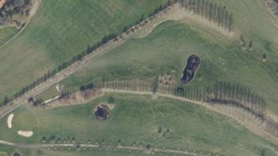
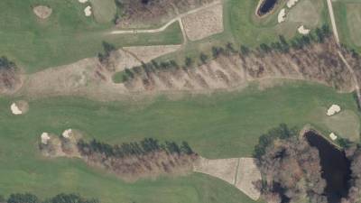
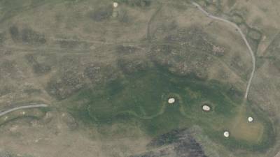
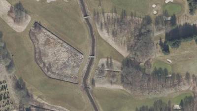
Danish Golf Courses Orthophotos dataset has 1123 images. Click on one of the examples below or open "Explore" tool anytime you need to view dataset images with annotations. This tool has extended visualization capabilities like zoom, translation, objects table, custom filters and more. Hover the mouse over the images to hide or show annotations.

























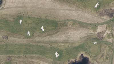

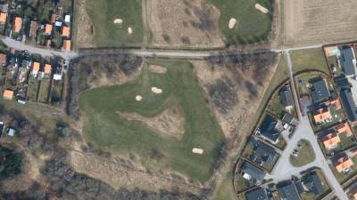

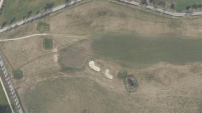

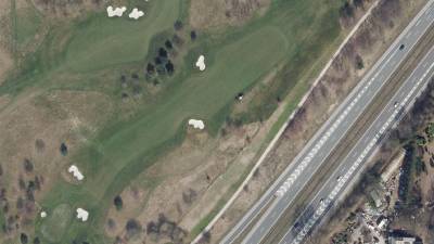


Class balance #
There are 5 annotation classes in the dataset. Find the general statistics and balances for every class in the table below. Click any row to preview images that have labels of the selected class. Sort by column to find the most rare or prevalent classes.
Class ㅤ | Images ㅤ | Objects ㅤ | Count on image average | Area on image average |
|---|---|---|---|---|
bunker➔ mask | 1077 | 5912 | 5.49 | 0.81% |
green➔ mask | 1074 | 2499 | 2.33 | 1.38% |
fairway➔ mask | 1070 | 2899 | 2.71 | 14.14% |
tee➔ mask | 1061 | 3881 | 3.66 | 0.59% |
water➔ mask | 665 | 1920 | 2.89 | 2.8% |
Co-occurrence matrix #
Co-occurrence matrix is an extremely valuable tool that shows you the images for every pair of classes: how many images have objects of both classes at the same time. If you click any cell, you will see those images. We added the tooltip with an explanation for every cell for your convenience, just hover the mouse over a cell to preview the description.
Images #
Explore every single image in the dataset with respect to the number of annotations of each class it has. Click a row to preview selected image. Sort by any column to find anomalies and edge cases. Use horizontal scroll if the table has many columns for a large number of classes in the dataset.
Object distribution #
Interactive heatmap chart for every class with object distribution shows how many images are in the dataset with a certain number of objects of a specific class. Users can click cell and see the list of all corresponding images.
Class sizes #
The table below gives various size properties of objects for every class. Click a row to see the image with annotations of the selected class. Sort columns to find classes with the smallest or largest objects or understand the size differences between classes.
Class | Object count | Avg area | Max area | Min area | Min height | Min height | Max height | Max height | Avg height | Avg height | Min width | Min width | Max width | Max width |
|---|---|---|---|---|---|---|---|---|---|---|---|---|---|---|
bunker mask | 5912 | 0.15% | 4.85% | 0% | 4px | 0.44% | 577px | 64.11% | 53px | 5.92% | 4px | 0.25% | 932px | 58.25% |
tee mask | 3881 | 0.16% | 1.73% | 0% | 7px | 0.78% | 388px | 43.11% | 51px | 5.72% | 6px | 0.38% | 384px | 24% |
fairway mask | 2899 | 5.22% | 23.94% | 0.01% | 14px | 1.56% | 900px | 100% | 304px | 33.82% | 16px | 1% | 1600px | 100% |
green mask | 2499 | 0.59% | 7.85% | 0.01% | 8px | 0.89% | 772px | 85.78% | 103px | 11.4% | 6px | 0.38% | 728px | 45.5% |
water mask | 1920 | 0.97% | 40.77% | 0% | 4px | 0.44% | 900px | 100% | 141px | 15.71% | 4px | 0.25% | 1600px | 100% |
Spatial Heatmap #
The heatmaps below give the spatial distributions of all objects for every class. These visualizations provide insights into the most probable and rare object locations on the image. It helps analyze objects' placements in a dataset.

Objects #
Table contains all 17111 objects. Click a row to preview an image with annotations, and use search or pagination to navigate. Sort columns to find outliers in the dataset.
Object ID ㅤ | Class ㅤ | Image name click row to open | Image size height x width | Height ㅤ | Height ㅤ | Width ㅤ | Width ㅤ | Area ㅤ |
|---|---|---|---|---|---|---|---|---|
1➔ | fairway mask | skovbo_1000_008.jpg | 900 x 1600 | 575px | 63.89% | 1220px | 76.25% | 8.4% |
2➔ | fairway mask | skovbo_1000_008.jpg | 900 x 1600 | 163px | 18.11% | 145px | 9.06% | 1.16% |
3➔ | fairway mask | skovbo_1000_008.jpg | 900 x 1600 | 327px | 36.33% | 843px | 52.69% | 7.17% |
4➔ | green mask | skovbo_1000_008.jpg | 900 x 1600 | 66px | 7.33% | 119px | 7.44% | 0.47% |
5➔ | green mask | skovbo_1000_008.jpg | 900 x 1600 | 123px | 13.67% | 111px | 6.94% | 0.64% |
6➔ | tee mask | skovbo_1000_008.jpg | 900 x 1600 | 97px | 10.78% | 83px | 5.19% | 0.32% |
7➔ | tee mask | skovbo_1000_008.jpg | 900 x 1600 | 46px | 5.11% | 50px | 3.12% | 0.12% |
8➔ | tee mask | skovbo_1000_008.jpg | 900 x 1600 | 45px | 5% | 50px | 3.12% | 0.12% |
9➔ | bunker mask | skovbo_1000_008.jpg | 900 x 1600 | 58px | 6.44% | 61px | 3.81% | 0.14% |
10➔ | bunker mask | skovbo_1000_008.jpg | 900 x 1600 | 36px | 4% | 50px | 3.12% | 0.1% |
License #
Citation #
If you make use of the Danish Golf Courses Orthophotos data, please cite the following reference:
@dataset{Danish Golf Courses Orthophotos,
  author={Jesper Kjærgaard Mortensen and Vinicius Soares Matthiesen and Jacobo Gonzalez de Frutos and Kata Bujdoso and Jesper Thøger Christensen and Andreas Møgelmose},
  title={Danish Golf Courses Orthophotos},
  year={2023},
  url={https://www.kaggle.com/datasets/jacotaco/danish-golf-courses-orthophotos}
}
If you are happy with Dataset Ninja and use provided visualizations and tools in your work, please cite us:
@misc{ visualization-tools-for-danish-golf-courses-orthophotos-dataset,
  title = { Visualization Tools for Danish Golf Courses Orthophotos Dataset },
  type = { Computer Vision Tools },
  author = { Dataset Ninja },
  howpublished = { \url{ https://datasetninja.com/danish-golf-courses-orthophotos } },
  url = { https://datasetninja.com/danish-golf-courses-orthophotos },
  journal = { Dataset Ninja },
  publisher = { Dataset Ninja },
  year = { 2026 },
  month = { feb },
  note = { visited on 2026-02-15 },
}
Download #
Dataset Danish Golf Courses Orthophotos can be downloaded in Supervisely format:
As an alternative, it can be downloaded with dataset-tools package:
pip install --upgrade dataset-tools
… using following python code:
import dataset_tools as dtools

dtools.download(dataset='Danish Golf Courses Orthophotos', dst_dir='~/dataset-ninja/')
Make sure not to overlook the python code example available on the Supervisely Developer Portal. It will give you a clear idea of how to effortlessly work with the downloaded dataset.
The data in original format can be downloaded here.
Disclaimer #
Our gal from the legal dep told us we need to post this:
Dataset Ninja provides visualizations and statistics for some datasets that can be found online and can be downloaded by general audience. Dataset Ninja is not a dataset hosting platform and can only be used for informational purposes. The platform does not claim any rights for the original content, including images, videos, annotations and descriptions. Joint publishing is prohibited.
You take full responsibility when you use datasets presented at Dataset Ninja, as well as other information, including visualizations and statistics we provide. You are in charge of compliance with any dataset license and all other permissions. You are required to navigate datasets homepage and make sure that you can use it. In case of any questions, get in touch with us at hello@datasetninja.com.


